Date : Feb 6, 2006
Total Distance : 85 + 30 + 61 = 176 KMs
Expense : 100 (petrol) + 75 (cigarettes) + 150 (food) + 40 (drinks) + 30 (snacks) = 395 Rs.
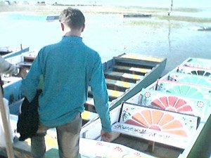
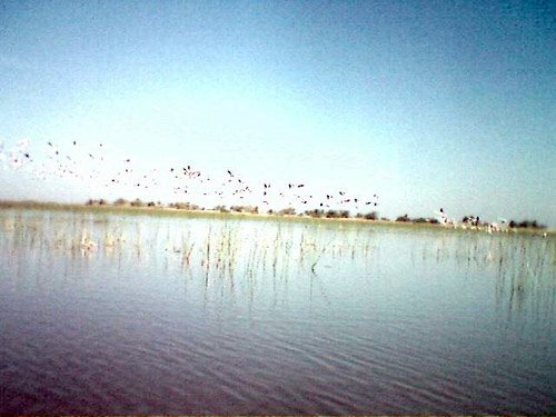
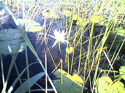
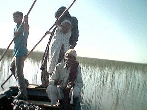
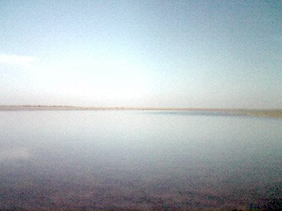
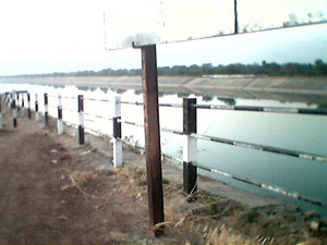
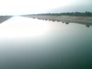
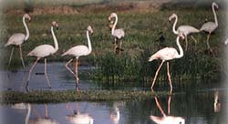
Nalsarovar lake is 80 KMs from Ahmedabad. The Lake is spread over an area of 115 sq. KM. It is believed to harbour more that 250 species of birds. In winter, the birds migrate from north and descend in thousands. Visitors cam glide slowly through the silent waters in small boats. Some prominent birds found here are jacanas, moorhens, coots, grebes, kingfishers, egrets, darters, storks, cormorants and ducks.
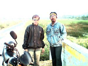
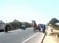
Our Plan was to get there before sun-rise (sun rises in these parts at around 6.30-6.45). There was a highway till Sanand. We started at 4.50 and our initial thoughts we will reach there on time with a speed of 45-50 (which is our average speed!! Safe drivers we are!!) but we lost our way asking some people the direction. Either we didn’t understand it or that guy really didn’t know the route but what happened was we lost 15-20 minutes because of that. The route from Sanand to Nalsarovar was excellent. Quite narrow but the road was too smooth. The best part was the two-three vehicles we found on that road were all going to Nalsarovar and none came opposite us. So we thought its safe to touch 70 speed but like it always happens, we were driving at 85 in five minutes. The only problem was the light. The roads didn’t have any light on either side and it was 5.30 in the morning. So the guy driving behind had to totally rely on the one in front for the route. It was a bit risky since at a speed of 85, you cant have lot of control if you want to turn suddenly and either side of the narrow roads were trees for most of the part and in between there were bridges with farms below. But we were good enough bikers and reached Nalsarovar at 6.25.
But But But…. There was annual bird census going on and we weren’t allowed inside. The news was in today’s papers but then no part of Ahmedabad gets newspapers at 4.45!! It was very very disappointing. We waited there for half an hour giving our bikes some rest and also hoping the security guys will have a change of heart and allow us inside. Three more cars came and all were told that they cant enter today. We felt happy!! Weren’t the only ones!!

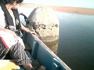
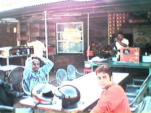
Lothal, a Harappan site was 30 KMs from Nalsarovar. We thought instead of going back we will visit it instead. We first had to reach Bagodara (20 kms away) and the to Lothal. We took a shortcut to Bagodara and the road was a bit too narrow and was being constructed. But the scenes on both sides. Green Green farms and lots of birds more than made up for the bad roads. So had to go at a speed of 40. We stopped often to see what farms were there and tried to catch a bird on our camera. In Bagodara, we filled petrol again as the trip was going to be 100 KMs more than what we had planned. Also we found a roadside restaurant and had tea and cholafali (a local delicacy).

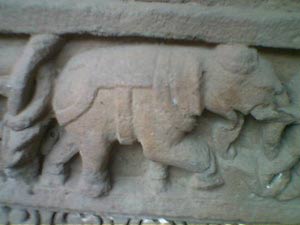
The Road from Bagodara to Lothal was a beauty. Spotlessly clean inspite of having more traffic. Average speed there was 60. We reached Lothal at around 10.30AM. Lothal is in Saragwala village in Dholka Taluka of Ahmedabad district. Meaning of ‘Lothal’ is ‘Place of the Dead’

At first we saw some stones, some water and that’s all. We were very disappointed. We had heard so much about it and it didn’t live upto our expectations. The problem was i) none of us had very good knowledge of the history and ii) we couldn’t understand most things and iii)most of the excavated things were re-filled.

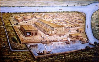
Then we decided to check its museum. We checked the an image illustrating how it was in those times. We started comparing that with what we saw outside and understood a bit more.
The museum had a book on Lothal but it was a bit too much in detail. Instead the archeologist there generously gave us a four page brochure with basic info on Lothal. The following info are taken from it.
The site was excavated by Dr.S.R.Rao from 1955-1962 which unearthed many structural remains of Harappan town (2500-1900 BC)
The entire settlement was divided into
- Acropolis
- Lower town
AcropolisThe chief lived in the acropolis where houses were built on 3M high platforms and provided iwht all the civic amenities including paved baths, underground drains and a well for portable water.
Lower townThe lower town was subdivided into two sectors. I) the main commercial centre in which craftsmen lived and the other is residential sector.
The bead factories, situated where the 8th street of the commercial area and the 5th street of the residential area meet, comprised the main industry of the Harappans. They probably settled (or their culture came) to the Gulf of Cambay region because of its agate and precious stone resources
The factory comprised 11 rooms, which included worker's quarters, warheouses and guard rooms, surrounding a courtyard. The main bead making machine was a twisted chambered kiln, made from mud plastered bricks, which was used for heating the stones used to make beads. Bellows helped raise the temperatures within.
Lothal was especially famous for its micro-beads. These were made by grinding materials, rolling them on to a string, baking it solid. Finally the baked roll was sawed into required shapes and sizes.
Unique necklaces were made with microbeads of gold. Some were as little as 0.25mm in diameter. They are testimony to the science of beadmaking perfected by the Indus Valley civilization, and has not been surpassed by artisans in the Gulf of Cambay today.
The middle classes who could not afford gold contented themselves with gilded copper wires. Low income groups must have worn ornaments from shells and clay. Coppersmithing and pottery reached high standards of development in the lower town.
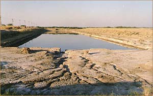
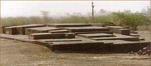
The Dock
The dominant sight at Lothal is the massive dockyard which has helped make this place so important to international archaeology. Spanning an area 37 meters from east to west and nearly 22 meters from north to south, the dock is said by some to be the greatest work of maritime architecture before the birth of Christ. To be sure, not all archaeologists are convinced that the structure was used as a dockyard and some prefer to refer to it as a large tank that may have been a reservoir.
It was excavated besides the river Sabarmati, which has since changed course. The structure's design shows a thorough study of tides, hydraulics and the effect of sea water on bricks. Ships could have entered into the northern end of the dock through an inlet channel connected to an estuary of the Sabramati during high tide. The lock gates could then have been closed so the water level would rise sufficiently for them to float.
An inlet channel 1.7 meters above the bottom level of the 4.26 meter deep tank allowed excess water to escape. Other inlets prevented siltation of the tanks and erosion of the banks. After a ship would have unloaded its cargo, the gates would have opened and allowed it to return to the Arabian sea waters in the Gulf of Combay.
Archaeological finds from the excavations testify to trade with ancient Egypt and Mespotamia. The hydraulic knowledge of the ancient Harappans can be judged by the fact that boats could dock at Lothal in the 1850's. In 1942 timber was brought from Baruch to nearby Sagarwala. It is said that then the dockyard could hold 30 ships of 60 tons each or 60 ships of 30 tons each. This would be comparable to the modern docks at Vishakapatnam.
Warehouse
A long wharf connected the dockyard to the main warehouse, which was located on a plinth some 3.5 meters above the ground. The first concern of the Harappan engineers might have been to ensure against floods and tides (which may have been their undoing at Mohenjo-daro and Harappa).
The whole town was situated on a patch of high ground. Rising from the flat alluvial plains of Bhal a wall was erected to encircle the town, and a platform was built where goods were checked and stored. The warehouse was divided into 64 rooms of around 3.5 square meters each, connected by 1.2 meter wide passages. Twelve of these cubical blocks are visible today.
Seals were used to label imports and exports passing through the dock. Some of these labels or tags have been found during excavations. Kiln fired bricks, which the Harappans had learned were unaffected by tidal waters, were used in making the passages to protect the cargo
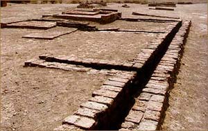
Drainage System
An elaborate sanitary and drainage system, a hallmark of ancient Indus cities, is in evidence everywhere at Lothal
The most unique aspect of planning during the Indus Valley civilization was the system of underground drainage. The main sewer, 1.5 meters deep and 91 cm across, connected to many north-south and east-west sewers. It was made from bricks smoothened and joined together seamlessly. The expert masonry kept the sewer watertight. Drops at regular intervals acted like an automatic cleaning device.
A wooden screen at the end of the drains held back solid wastes. Liquids entered a cess poll made of radial bricks. Tunnels carried the waste liquids to the main channel connecting the dockyard with the river estuary. Commoner houses had baths and drains that emptied into underground soakage jars.
Return 
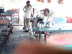
We decided to come back at 2. First we went to a cheap looking (price wise) kathiyawadi restaurant. This was the worst part of the trip. The food was below average, I got a duplicate-thumbs up and it cost us 150!!!!
I have no words for the highway on which we came back!! Extremely straight and smooth, there wasn’t much traffic and we easily went at 70-75. It was one straight road and reached Ahmedabad at 3.30.

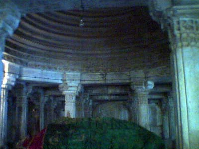
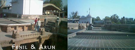
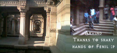
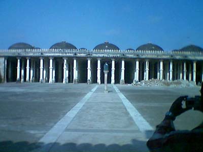 Well since all our plans for a long trip was nearly failing much faster compared to a deck of cards… We suddenly planned to visit the Sarkej Roza located around 1.5 km from the Sarkej Circle of the Sarkej-Gandhinagar Highway… A trip that is approximately 10-11 kms from our rendezvous point…
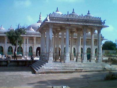
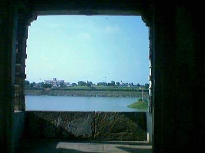
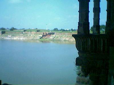
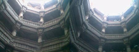
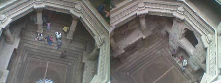
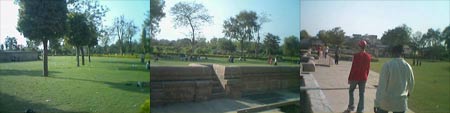
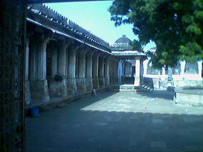 Reached there at around 0920 hrs… Went inside and saw all the historic sites… The sight was quite stupendous and breathtaking… But for the first time we wish that instead of words, we would let our pictures do the talking and we would just like to incorporate a few lines on the history of this building and its architecture…